 CNR-ISMAR
ESRI Shapefile
Type of resources
Available actions
Topics
INSPIRE themes
Provided by
Years
Formats
Representation types
Update frequencies
status
-
Maritime zones as defined by the INSPIRE Directive("A belt of sea defined by international treaties and conventions, where coastal State executes jurisdictional rights"), that are: Internal waters, Territorial seas, Contigous zones and EEZs.
-
Polyline data showing the depth contours for the Mediterranean and Black Sea basins
-
Polygonsrepresenting depthranges in the Mediterranean and Black Sea basins
-
Protected sites with a national designation
-
Protected sites with an international designation
-
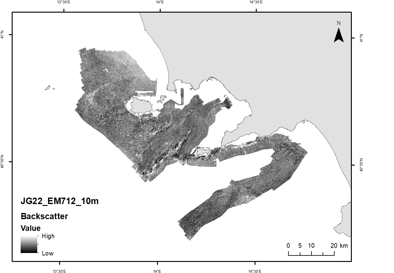
Acoustic reflectivity data (multi beam backscatter) collected during the oceanographic cruise JAMME GAIA 2022 on board of the R/V GAIA BLU by CNR.
-
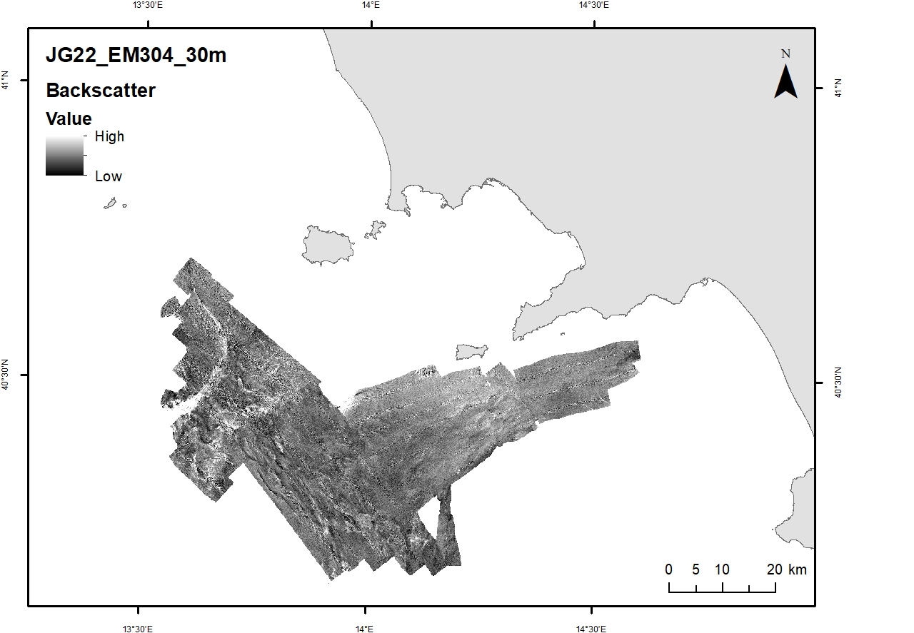
Acoustic reflectivity data (multi beam backscatter) collected during the oceanographic cruise JAMME GAIA 2022 on board of the R/V GAIA BLU by CNR.
-
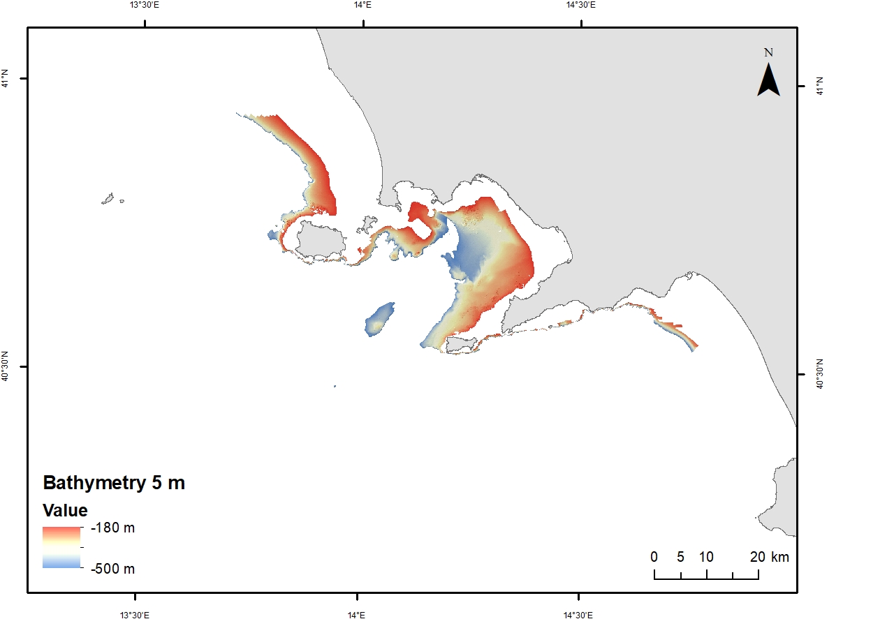
Digital Elevation Model (DEM) from 980 to 1200 water depth at 30 meters resolution. Bathymetric surface collected during the oceanographic cruise JAMME GAIA 2022 on board of the R/V GAIA BLU by CNR.
-
Digital Elevation Model (DEM) from 100 to 200 m water depth with a spatial resolution of 5 m. Bathymetric surface collected during the oceanographic cruise JAMME GAIA 2022 on board of the R/V GAIA BLU by CNR.
-
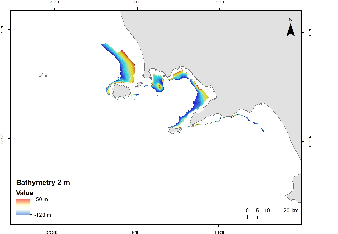
Digital Elevation Model (DEM) from 50 to 120 mwater depth with a spatial resolution of 2 m. Bathymetric surface collected during the oceanographic cruise JAMME GAIA 2022 on board of the R/V GAIA BLU by CNR.